Countryside Signs
Know the signs and symbols of the countryside
A yellow arrow
Footpath
A right of way for walkers and mobility aid users.
A purple arrow
Restricted byway
A right of way for walkers, mobility aid users, cyclists, horse-riders and horse-drawn vehicles only.
An acorn symbol
National Trail
National Trail, created for walking, with horse-riding and cycling possible on some trails. Users with limited mobility can visit the National Trail website to check trail suitability. This website also contains maps, trip planning tools and information on trail diversions. This symbol marks 16 long-distance routes in England and Wales including the England Coast Path.
A blue arrow
Bridleway
A right of way for walkers, mobility aid users, horse-riders and cyclists.
A red arrow
Byway open to all traffic
Byway open to all traffic, a right of way for all users including motorised vehicles.
Person walking over hills
Open Access
You can explore away from paths. This includes many areas of:
- mountain
- moorland
- heath
- down
- coastal margin
- registered common land
Check the Open Access website for maps, information and any access restrictions.
Walking Gear
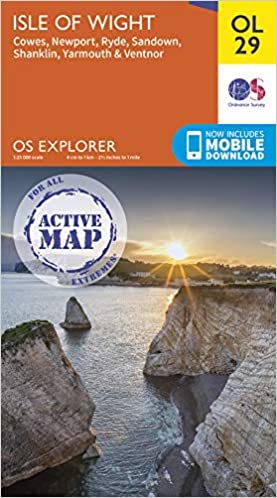
OS Explorer Active OL29 Isle of Wight
Map sheet number OL29 in the OS Explorer map series is the perfect map for your days out and holidays on the Isle of Wight.
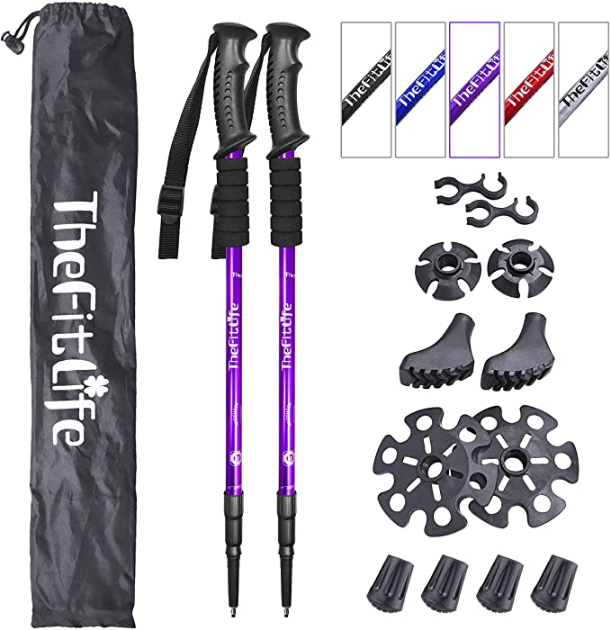
FitLife Hiking Walking Trekking Poles
Anti Shock, Absorbing Poles - With the High Quality 7 Series Aviation Aluminum Material. Ideal for Island walking.
Chilly's Leak-Proof, BPA-Free Bottles
Double-wall insulation maintains temperatures inside. food-grade stainless steel leak-proof drinking bottle.
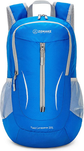
ZOMAKE Ultra Lightweight Packable Backpack
Ultra-light. Ultra-durable. Ultra-awesome. The backpack is perfect for day-to-day use for walking on the Isle of Wight.
Travel Water Bottle for Dogs & Pets
Ideal for walking and travelling with your dog, and includes a bottle carabiner that can be attached to your backpack.