Isle of Wight Tides
Don't get caught out
Isle of Wight Tide Times
Please note that high and low tide times vary across the Island, and the amount of tidal movement varies greatly with the moon phase. Below are locations in the north, east, south and west of our coast.
Cowes Tides
29 March 2025
| Time | Type | Height |
| 04:11 | low | 0.6m |
| 10:25 | high | 4.4m |
| 16:31 | low | 0.4m |
| 22:52 | high | 4.5m |
30 March 2025
| Time | Type | Height |
| 05:53 | low | 0.4m |
| 12:06 | high | 4.5m |
| 18:13 | low | 0.3m |
31 March 2025
| Time | Type | Height |
| 00:49 | high | 4.5m |
| 06:34 | low | 0.4m |
| 12:49 | high | 4.5m |
| 18:52 | low | 0.4m |
Copyright 2025 © Tides Today. By using this data, you are agreeing to the Terms and Conditions
Bembridge Tides
29 March 2025
| Time | Type | Height |
| 04:22 | low | 0.71m |
| 10:54 | high | 4.82m |
| 16:40 | low | 0.48m |
| 23:24 | high | 4.98m |
30 March 2025
| Time | Type | Height |
| 06:02 | low | 0.53m |
| 12:34 | high | 4.93m |
| 18:20 | low | 0.4m |
31 March 2025
| Time | Type | Height |
| 01:04 | high | 5.03m |
| 06:42 | low | 0.47m |
| 13:17 | high | 4.96m |
| 19:00 | low | 0.44m |
Copyright 2025 © Tides Today. By using this data, you are agreeing to the Terms and Conditions
Ventnor Tides
29 March 2025
| Time | Type | Height |
| 03:56 | low | 0.86m |
| 10:38 | high | 3.92m |
| 16:14 | low | 0.71m |
| 23:08 | high | 4.04m |
30 March 2025
| Time | Type | Height |
| 05:36 | low | 0.74m |
| 12:18 | high | 4m |
| 17:54 | low | 0.65m |
31 March 2025
| Time | Type | Height |
| 00:48 | high | 4.08m |
| 06:16 | low | 0.7m |
| 13:01 | high | 4.02m |
| 18:34 | low | 0.68m |
Copyright 2025 © Tides Today. By using this data, you are agreeing to the Terms and Conditions
Freshwater Bay Tides
29 March 2025
| Time | Type | Height |
| 03:26 | low | 0.3m |
| 09:07 | high | 2.5m |
| 15:44 | low | 0.1m |
| 21:38 | high | 2.4m |
30 March 2025
| Time | Type | Height |
| 05:08 | low | 0.2m |
| 10:50 | high | 2.6m |
| 17:27 | low | 0.1m |
| 23:20 | high | 2.5m |
31 March 2025
| Time | Type | Height |
| 05:49 | low | 0.1m |
| 11:36 | high | 2.5m |
| 18:09 | low | 0.1m |
01 April 2025
| Time | Type | Height |
| 00:06 | high | 2.4m |
Copyright 2025 © Tides Today. By using this data, you are agreeing to the Terms and Conditions
Walking Gear

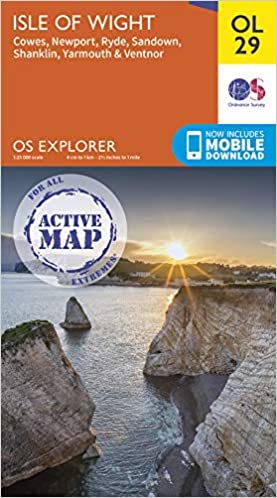
OS Explorer Active OL29 Isle of Wight
Map sheet number OL29 in the OS Explorer map series is the perfect map for your days out and holidays on the Isle of Wight.

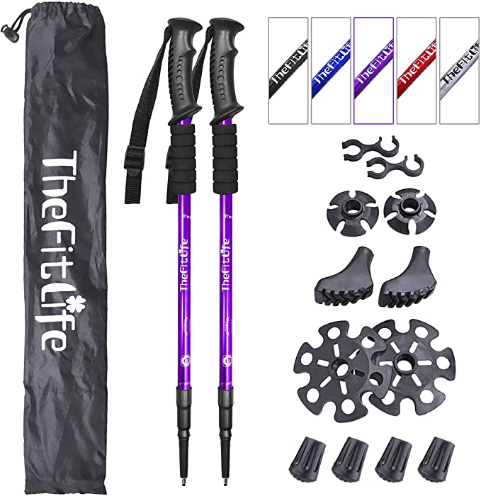
FitLife Hiking Walking Trekking Poles
Anti Shock, Absorbing Poles - With the High Quality 7 Series Aviation Aluminum Material. Ideal for Island walking.

Chilly's Leak-Proof, BPA-Free Bottles
Double-wall insulation maintains temperatures inside. food-grade stainless steel leak-proof drinking bottle.

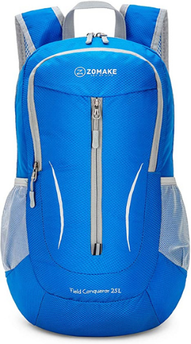
ZOMAKE Ultra Lightweight Packable Backpack
Ultra-light. Ultra-durable. Ultra-awesome. The backpack is perfect for day-to-day use for walking on the Isle of Wight.

Travel Water Bottle for Dogs & Pets
Ideal for walking and travelling with your dog, and includes a bottle carabiner that can be attached to your backpack.
Tides on the Isle of Wight
The Isle of Wight, with its picturesque coastline and bustling harbours, is deeply influenced by the ebb and flow of the tides. Understanding the tidal patterns is crucial for sailors, fishermen, and beachgoers who want to make the most of their time on the island. This page provides an overview of the tidal conditions around the Isle of Wight, along with specific information about the island’s key harbours.
Tidal Information for Isle of Wight Harbours
Cowes Harbour
Cowes Harbor, situated on the northern coast of the Isle of Wight, is renowned for its vibrant maritime activity and sailing events, including the famous Cowes Week regatta. The tides in Cowes are semi-diurnal, meaning there are two high tides and two low tides each day. The harbour’s tidal range can vary significantly, with high water providing ample depth for larger vessels. It’s essential for sailors to check tide tables to plan their entry and exit, particularly during low water when the harbour entrance can be shallower. Cowes is well-equipped with marinas and moorings, making it a popular destination for yachtsmen and pleasure boaters.
Bembridge Harbour
Bembridge Harbour, on the eastern coast of the Isle of Wight, is a key site for recreational boating and fishing. The harbour’s tidal range is notable, with significant differences between high and low water levels. At low tide, the entrance to Bembridge can be tricky due to the shallow sandbanks, making it essential for boaters to navigate with caution and consult tide tables. High tide provides sufficient depth for most vessels, allowing safe access to the harbour’s facilities and moorings. Bembridge is a serene spot known for its natural beauty and tranquil waters.
Ventnor Haven
Ventnor Haven, located on the southern coast of the Isle of Wight, is a small but significant harbour primarily used for fishing and small boats. The tidal influence here is critical for harbour operations, as the haven is exposed to the open sea. Tides can bring significant changes in water depth and conditions, impacting both fishing activities and recreational boating. High tide offers safer and easier access to the haven, while low tide can reveal rocky outcrops and limit entry. Ventnor’s coastal scenery and charming town make it a delightful destination for visitors.
Newport Harbour
Newport Harbour, located at the heart of the Isle of Wight, is accessible via the River Medina. Tides play a crucial role in navigating this inland waterway, as the river’s tidal range affects the water depth significantly. At high tide, boats can navigate up to Newport Quay, while low tide can expose mudflats and reduce navigable depths. Boaters need to plan their trips carefully around the tidal schedule to ensure safe passage. The harbour area is a hub for small boats and offers picturesque views of the surrounding town and countryside.
Yarmouth Harbour
Yarmouth Harbour, on the island’s western tip, faces the Solent and is known for its historical charm and strategic importance. The tidal flow here can be strong due to its position near the narrowest point of the Solent. Tides in Yarmouth are semi-diurnal, with a considerable range that affects harbour operations. High tide allows for easier access for larger vessels, while low tide may limit entry to shallower draft boats. Yarmouth’s marina facilities and sheltered waters make it an attractive stop for sailors exploring the Solent and the Isle of Wight.
Understanding Isle of Wight Tides
Tides around the Isle of Wight are influenced by both lunar and solar gravitational forces, resulting in regular and predictable tidal patterns. The island’s coastal geography can create localised variations in tidal ranges and currents, making it essential for mariners and visitors to be aware of specific conditions in different areas. Tide tables and charts are valuable tools for planning activities and ensuring safety while enjoying the island’s beautiful coastline and maritime attractions.
By staying informed about the tides and understanding the unique characteristics of each harbour, you can fully appreciate the maritime heritage and natural beauty of the Isle of Wight. Whether you’re sailing, fishing, or simply exploring the beaches, the island’s tides add a dynamic and fascinating aspect to your adventure.
